The Lemosho Route is a newer route on Mount Kilimanjaro that approaches from the west. It is a difficult and long route, but one that is favored by most reputable Kilimanjaro outfitters due to its smaller crowds, scenic variety and high success rates.
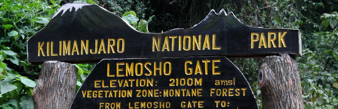
A vehicle is used to bring climbers to the gate, where the trail begins in the rainforest. Lemosho trekkers have a longer distance to cover in the rainforest ecosystem than other routes, and as a result climbers do not exit the rainforest until the end of day two. This schedule means that the Lemosho Route is a longer route, usually taking seven to eight days to complete.
Though considered a difficult route, the added days on the lower slopes of the mountain make this the best route for altitude acclimatization. The descent is down Mweka, in the south-east. Because the starting point is far from Moshi, it is more expensive to climb this route due to the added transportation cost of getting climbers to the gate. Scenically, Lemosho is considered the most varied and most beautiful because it begins in the rainforest, crosses the spectacular Shira Plateau, and then combines with the Machame route to share its viewpoints around the southern circuit. Lemosho has low crowds until it combines with Machame.
Lemosho is ideal for those who place a premium on proper altitude acclimatization, who are confident in their ability to walk over steeper paths for extended periods, and want a lesser used route. However, Lemosho is also more expensive than the other routes.
Itinerary
DAY 1 - STARTING POINT TO BIG TREE CAMP
From Lemosho Start Point (2,424 m) to Forest Camp (2,821 m) the distance is 5.4 km, over 400 m of elevation gain. You are advised to stop regularly today and to move quietly in the hope of sighting wildlife near to the trail. Sightings of small antelope are virtually unique to the Lemosho and Rongai Routes.
- Elevation:
- Distance: 5.4 km
- Hiking Time:
- Habitat:
DAY 2 - BIG TREE CAMP TO SHIRA 1
Trek from Forest Camp to Shira 1 Camp (3,508 m) on western edge of Shira Plateau. It is normal to experience mild headaches on this day that should be alleviated with paracetamol. Those choosing to take Diamox should begin their course this morning with half a tablet (125 mg) in the morning and the other half with supper in the evening. The distance to Shira 1 is 7.7 km. Optional afternoon acclimatisation ascent of Shira Ridge 3,959 m (Kilimanjaro’s 3rd volcanic summit) for arguably best views of Kibo (clear weather permitting). Descend to sleep lower at Shira One 3,508 m for overnight.
- Elevation:
- Distance: 7.6 km.
- Hiking Time:
- Habitat:
DAY 3 - SHIRA 1 TO MOIR HUT
Trek from Shira 1 Camp (3,508 m) to Moir Hut (4,166 m) across Shira Plateau before rising along the flank of a re-entrant. Height gain 658 m. Sunset acclimatisation before dinner to 4,305 m to ridge.
- Elevation:
- Distance: 9.4 km, excursion 1.9 km
- Hiking Time:
- Habitat:
DAY 4 - MOIR HUT TO THIRD CAVE
Trek clockwise around the northern slopes of Kilimanjaro from Moir Hut (4,166 m) to 3rd Caves Camp (3,971 m). Gradual traversing of Kili with classic views to the Northwest, North and Northeast.
- Elevation:
- Distance: 17 km
- Hiking Time:
- Habitat:
DAY 5 - THIRD CAVE TO SCHOOL HUT
After gently traversing the northern slopes of Kilimanjaro, today we trek upwards from 3rd Caves Camp (3,971 m) to School Hut (4,722 m). Shorter distance than previous 2 days, but 751 m of height gain.
- Elevation:
- Distance: 4.9 km
- Hiking Time:
- Habitat:
DAY 6 - SCHOOL HUT TO UHURU PEAK TO MWEKA HUT
After being wake up with the staff and have something to eat in order to gaining the energy, you will quit camp for the assault via Gilman’s Point (5,708m) to the summit. Tonight is very difficult - particularly the final 550m - and you’ll need to commit to fight for the summit. You will inevitably feel like giving up and going to sleep. This is normal and can be overcome with perseverance. When resting please ensure you only stand or sit and do not lie down or close your eyes. Please trust your guide; he is very adept at judging whether your condition will allow safe progress or whether you have succumbed to a potentially dangerous condition and to proceed will not be safe. Nausea and headaches are normal and around a quarter of climbers will vomit at or near Gilman’s Point.
When you reach at Gilmans Point you will feel like give up, proceeding Pole Pole (Slowly Slowly) to Stella point and the trail is good due to up and down walking on the crater rim this will encourage you to push more toward Uhuru peak (5,895m)
- Elevation:
- Distance: 5.4 km Summit to Barafu: 4.5 km Barafu to Mweka Camp: 6.3 km Total 16.2 km
- Hiking Time:
- Habitat:
DAY 7 - MWEKA HUT TO MWEKA GATE
This morning we descend from Mweka Camp to Mweka Gate (1641m) where we sign out and receive your summit certificates. At lower elevations, it can be wet and muddy. Gaiters and trekking poles will help. Shorts and t-shirts will probably be plenty to wear (keep rain gear and warmer clothing handy).After getting to the gate you will sign out and drive to Moshi town for Lunch then proceeding with the journey to Arusha for hotel.
- Elevation: 3050 m to 1650 m
- Distance: 9 km
- Hiking Time: 3-4 hours
- Habitat: Rain Forest