The Rongai Route is the only route that approaches Kilimanjaro from the North, near the Kenyan border. Rongai's ascent profile is very similar to that of Marangu. It is one of Kilimanjaro's easier routes. The climb to the top is gradual and steady.
However, unlike Marangu, this route has low crowds and passes through remote wilderness areas. It is probably the only route where seeing wildlife in the first days is possible. The route takes six days minimum to complete, although seven days is recommended. The descent is down Mweka, on the south-east side of the mountain. Because the starting point is far from Moshi, it is more expensive to climb this route due to the added transportation cost of getting climbers to the gate.
Scenically, Rongai is beautiful because it travels through an unspoiled rain forest and remote wilderness area. However, it is not as scenically varied as Machame, Lemosho and Shira.
Rongai is ideal for those who are not confident in their ability to hike over steeper paths, those who want to avoid traffic, and those who want to enjoy a quieter hike. It is also preferred when climbing during the rainy season because the north side of the mountain receives less precipitation.
Itinerary
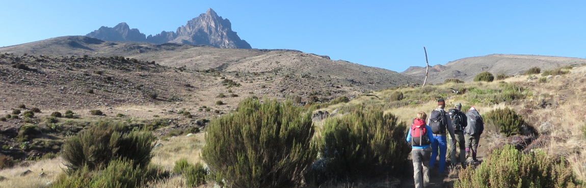
DAY 1 - RONGAI GATE TO SIMBA CAMP
Pick up from your hotel drive 2 hours to Marangu park gate for formalities registration after that transfer to the Rongai trailhead in about 3 hours. After arrived at Nalemuru will sign in and waiting the hot lunch, done with that you will start your hikking to Simba Camp. The small winding path crosses maize fields or potatoes before entering pine forest, and then climbs gently through a forest. The trail is not at all steep, but is rather a gentle hike through beautiful country. The first night’s camp is at Simba camp, at about 2,600 m. On the way you will have the chance to enjoy the beautifull view of the Kenya villages near the point where you start which called Laitoktok villange.
- Elevation: 1,950 m to 2,600 m
- Distance: About 8 km
- Hiking Time: 3-4 hours
- Habitat: Rainforest
DAY 2 - SIMBA CAMP TO SECOND CAVE (hot lunch) TO KIKELELWA
This is the long day and hard one for Rongai route. Early Breakfast, enjoy the morning at Simba camp proceed with the hiking very slowly acclimatize your body until you reach Second cave (3,450 m) for hot lunch. Soon you finish your lunch you can have a short break before proceeding with the hiking to Kikelelwa (3,600 m) camp for overnight, actually you will arrived there late so you can spend a short time then having the dinner.
- Elevation: 2,600 m to 3,600 m
- Distance: Simba to Second Cave: 5.2 km then 5.7 km to Kikelelwa camp (Total 10.9 km)
- Hiking Time 6-7 hours
- Habitat: Moorland
DAY 3 - KIKELELWA TO MAWENZI TARN HUT
It a nice with beautiful views during the morning time if you walk up early you can enjoy it. The hiking is short but steep climb up grassy slopes offers superb views of this wilderness area. The vegetation zone ends shortly before you reach your next camp at Mawenzi Tarn spectacularly situated beneath the towering spires of Mawenzi. On the way you can sport the nice view of Kibo peak on your right side. The views start to open up and you begin to feel you’re on a really big mountain. Spend the afternoon acclimatizing and exploring the area.
- Elevation:3,600 m to 4,330 m
- Distance: 4 km
- Hiking time: 3-4 hours
- Habitat: Alpine desert
DAY 4 - MAWENZI TUN - THIRD CAVE
This is good day and most lovely for all, it’s only losing the elevation from Mawenzi tarn hut 4,330m to Third Cave 3,940m, This day you will enjoy the view of the peak it’s so fantastic . And this day is important due to acclimatization factors, climb high and sleep low. If someone feeling bad from 4,330 m here is the day to recover.
- Elevation: 4,330 m to 3,971 m
- Distance: 9 km
- Hiking time: 4-5 hours
- Habitat: Moorland
DAY 5 - THIRD CAVE TO SCHOOL HUT
This day is short but most part are steeper and the pace recommended is Slowly(Pole Pole) you will be fit because of good rest due to the acclimatization point of view(Climb High and Sleep Low). You will have a good view of both peaks Kibo(5895m) and Mawenzi (5,149 m), today we trek upwards from 3rd Caves Camp (3,971 m) to School Hut (4,722 m). Shorter distance than previous 2 days, but 751 m of height gain.
- Elevation: 3971 m to 4,722 m
- Distance 4.9 km
- Hiking Time: 3-4 hours
- Habitart: Alpine desert
DAY 6 - SCHOOL HUT TO UHURU PEAK TO HOROMBO
The assault via School hut base camp is much good and advantages compare the Kibo hut due to loose scree slopes above Kibo Hut, we ascend from School Hut (4,722 m) via Hans Meyer Cave (5,243 m) and Gilman’s Point (5,708 m), to Uhuru Peak (5,895 m). The first section of the trail consists of a rocky path to the Hans Meyer Cave (5,150 m), also a good resting spot. The path then zigzags up to Gillman’s point (5,681 m), which is located on the crater rim. This section is very steep with a lot of stone scree, requiring a great physical and mental effort. This is probably the most demanding section of the entire route. Do the Kili shuffle and move slowly.
From Gillmans Point you will normally encounter snow all the way up to Uhuru peak (5,895m), the highest point in Africa. Total exhilaration and satisfaction – you made it. Weather conditions on the summit will determine how long you will be able to spend, taking photographs, before the 3 hour descent back to Kibo hut. After a short rest you gather all your gear you left behind for the ascent and head down to Horombo hut (3 hours) for your overnight. The return to Horombo hut will seem surprisingly fast compared to the ascent. The total time spent walking on this day is around 14 hours, so be prepared for a very tough day. Later in the evening you enjoy your last dinner on the mountain and a well-earned sleep, filled with memories and stirring emotions.
- Elevation: 4,722 m to 5,895 m to 3,705 m
- Hiking time: 7-8 hours to reach Uhuru Peak, 6-8 hours to descend to Horombo
- Distance: Approximately 5.4 km ascent and 15 km descent
- Habitat: Stone scree and ice-capped summit
DAY 7 - HOROMBO HUT TO MANDARA HUT TO MARANGU GATE
After breakfast you continue your descent (6 hours), passing the Mandara hut, down to the Marangu gate. At Marangu gate you sign your name and details in a register. This is also where successful climbers receive their summit certificates. Those climbers who reached Gillman’s Point (5,685 m) are issued with green certificates and those who reached Uhuru Peak (5,895 m), receive gold certificates. You now drive back to Moshi for hot Lunch then Arusha for a long overdue hot shower.
- Elevation: 3,705 m to 1,860 m
- Hiking time : 6 hours
- Distance: Approximately 20 km
- Habitat: Rain forest